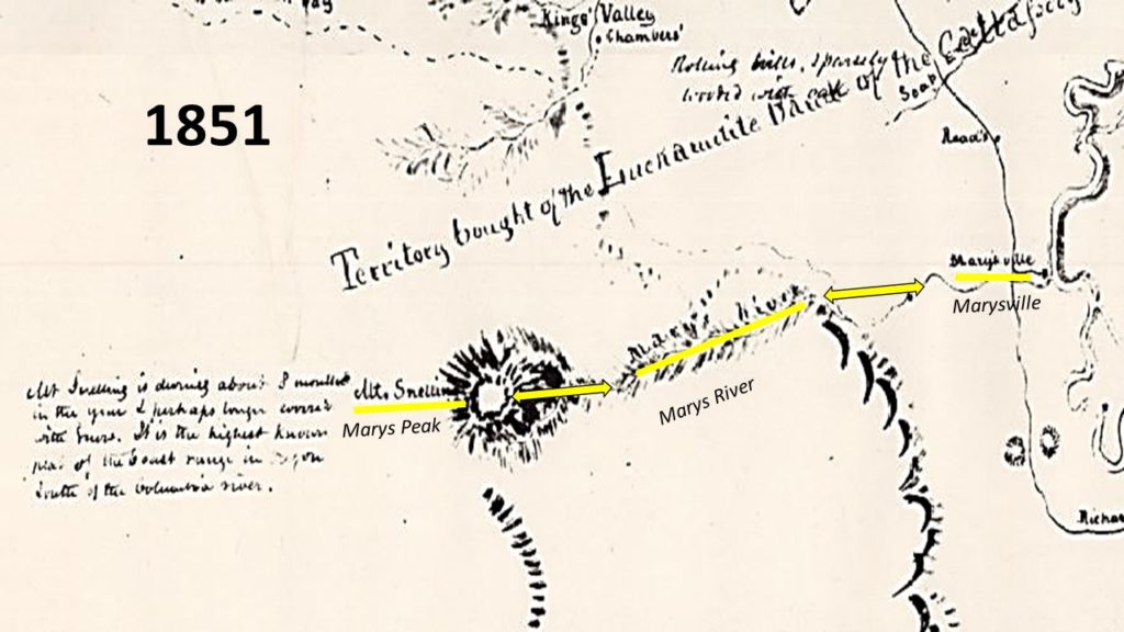
The attached 1852 map shows the Marys River flowing right by Shiver River. According to the local historian who sent this to me, this means that what is now Rock Creek was considered the primary source of Marys Peak and it directly connected Marys Peak and Marysville. This also means that the Rock Creek dam and other human impacts completely changed the hydrogeomorphology of the area until the drainage from Summit and the Tum Tum River overpassed the drainage coming from Rock and Greasy Creek. You will also note that Marys Peak was called Mt. Snelling. That was but one of 8 names for the mountain over a 40 year period. The name Marys Peak did predate 1852, but each mapmaker just used the last parochial name they heard from a local person as there was no consistent naming database that had yet developed.